
ArcGIS API for JavaScript tutors in postcode 700096

I'm ESRI Certified (ArcGIS Desktop Professional, ArcGIS JavaScript Specialty, ArcGIS Enterprise Administration Associate, ArcGIS Online Administration Specialty) and Have been in GIS Industry from 11+ Years with hands on experience on most of the prodcuts of ESRI'S ArcGIS Suite including:
ArcGIS Desktop (ArcMap, ArcGIS Pro)
ArcGIS...

With over 13 years of experience and a master's degree, I am a seasoned GIS professional dedicated to helping students excel. My expertise covers fundamental GIS concepts, as well as hands-on training with industry-standard software like ArcGIS and open-source alternatives such as QGIS and OpenGeoServer. I also specialize in geospatial automation...
I am a GIS Software Developer with a strong focus on applied geospatial solutions and mentoring learners who aspire to build their skills in GIS. I hold an M.Tech in Geoinformatics (2016) and have over 9 years of professional experience in GIS software development, covering a wide spectrum of domains and technologies.
Throughout my career, I...

Are you looking to master Geographic Information Systems (GIS) and remote sensing with the guidance of an expert? With over 5 years of professional experience in the corporate sector, I offer personalized GIS training that covers industry-leading software such as QGIS, ArcGIS, and more. My teaching style is highly interactive and student-centered,...
Biochemistry and Molecular Biology:
Strong knowledge of fundamental concepts in biochemistry and molecular biology, including protein structure and function, enzyme kinetics, gene expression, and cellular signaling pathways.
Ability to design and execute experiments to investigate biological phenomena, including PCR, Western blotting, and cell...

Hi! I’m Farhad Ali – Your Friendly GIS Expert & Mentor!
I am a GIS Officer in the telecom sector with a Master’s degree in GIS and 6 years of experience in teaching, mentoring, and technical GIS projects. I am passionate about empowering students to master GIS skills efficiently, confidently, and enjoyably.
I specialize in GIS mapping,...

Enthusiastic Educator & Urban Planning professional with 1.5+ years of GIS experience. Skilled in ArcGIS and ArcGIS Pro, with expertise in Spatial Analyst, digitizing, geodatabase creation, network analysis, image classification, and georeferencing. Adept at crafting informative maps and interactive story maps using ArcGIS Online. University...

I am a Senior Research Fellow (Ph.D.) at the Department of Earth Sciences, IIT Kanpur. I have qualified CSIR JRF (Earth, Atmospheric, Ocean and Planetary Sciences) June 2019 with AIR 42, GATE (Geology & Geophysics) 2019 with AIR 99, and CSIR NET (Earth, Atmospheric, Ocean and Planetary Sciences) June 2018 with AIR 07. I have a strong knowledge of...
- Nusrat Ullah Hasani
-
3.5

Over 3 years of experience achieving career excellence through committed and innovative work in the field of Remote Sensing and GIS. A versatile team player who thrives in enviroments requiring the ability to work effectively as a team player. Expertise includes satellite image processing and analysis and web GIS.
Provide Support in starting new...
As a dedicated and passionate tutor with over 5 years of hands-on experience in GIS, Remote Sensing, Drone Mapping, and Geospatial Analysis, I specialize in breaking down complex spatial concepts into simple, engaging lessons that students can easily understand and apply. Whether you're a beginner trying to navigate ArcGIS or a professional aiming...
As a committed practitioner in geography, I have a keen interest in using spatial analysis and geospatial technologies to comprehend the connections between individuals, locations, and ecosystems. I have a strong grasp of both physical and human geography thanks to my geography academic background, and I can turn complicated geographical data into...
- Ar. Astha Singh
-
4.7

Being an Architect and Urban planner (Gold medalist) from India's top colleges by education and Assistant professor by occupation. Apart from being a highest scorer in my B.Arch as well as M.Plan I am eager to learn and grow my knowledge more. Having completed my M.Plan with MHRD scholarship I am Gate qualified with ranking AIR 21. I will be...
- Vagmi Patel
-
5.0

With a master's in Geomatics and extensive experience in GIS projects, I offer valuable expertise to students. Proficient in ARCGIS Pro, ArcGIS Online, Google Earth Engine, SNAP, QGIS, etc., I can solve complex problems efficiently. Teaching various professionals has enriched my ability to tailor content for diverse learners.
Overall, I am a...
I am 4th year PhD candidate at University of California Irvine. I am working at UCI as research and teaching associate and have worked with a number of undergrad and graduate students. I am passionate about teaching biology, environmental science and policy, public health, and statistical analysis. I can also help you with homework and assignments...

I have an accumulated experience in GIS projects gained through working for years in the public sector in Syria such as The Center of Scientific Studies and Researches, General Organization of Remote Sensing and I worked in the private sector such as the United Nation Development Program UNDP. I also followed specialized training courses on...
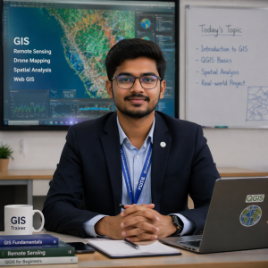
I am a passionate GIS Analyst and Trainer with strong experience in Geographic Information Systems (GIS), Remote Sensing, and Drone Mapping. I specialise in teaching both beginners and advanced learners seeking to build a strong career in geospatial technology.
I have hands-on experience working on real-world projects such as land use land...
I am working in the field of remote sensing and GIS for 5+ years and having the knowledge of ArcGIS and QGIS softwares. I have the knowledge related to the projects on spatial analysis using GIS softwares and various remote sensing data. Also I can work in google earth pro. I can help you regarding the methologies and procedure to do the spatial...
SUBJECTS TAUGHT ARE
ALL CIVIL ENGINEERING SUBJECTS.
REINFORCE CEMENT CONCRETE
SOIL AND FOUNDATION ENGINEERING
STRUCTURAL ANALYSIS
STRENGTH OF MATERIALS
MECHANICS OF SOLIDS
ENGINEERING MECHANICS
TRANSPORTATION
engineering mathematics
physics and mathematics+1and +2
ASSIGNMENTS COMPLETION IN TIME
BEGINNER TO EXPERT LEVEL
100 PERCENT...

Hai I'm a professionaly qualified GIS and Remote sensing expert with excellent hands on experience in various GIS softwares and Image processing softwares.
I'm a PhD fellow in Universiti Putra Malaysia, in Department of Agricultural technolgy. I've done my masters in Geoinformatics from Central University of Jharkhand, India and Bachelors in...
- Hadis Alinia
-
5.0

Are you looking for a knowledgeable, experienced, and passionate tutor to help you excel in your studies? With over two decades of expertise in Geomatics Engineering and GIS, I bring a unique blend of academic and industrial experience to guide you toward success.
Why Choose Me?
Ph.D. in Geomatics Engineering: Advanced understanding of GIS...

