
Online ArcGIS API for JavaScript tutors in postcode 500072
I am a GIS Software Developer with a strong focus on applied geospatial solutions and mentoring learners who aspire to build their skills in GIS. I hold an M.Tech in Geoinformatics (2016) and have over 9 years of professional experience in GIS software development, covering a wide spectrum of domains and technologies.
Throughout my career, I...

I'm ESRI Certified (ArcGIS Desktop Professional, ArcGIS JavaScript Specialty, ArcGIS Enterprise Administration Associate, ArcGIS Online Administration Specialty) and Have been in GIS Industry from 11+ Years with hands on experience on most of the prodcuts of ESRI'S ArcGIS Suite including:
ArcGIS Desktop (ArcMap, ArcGIS Pro)
ArcGIS...

With over 13 years of experience and a master's degree, I am a seasoned GIS professional dedicated to helping students excel. My expertise covers fundamental GIS concepts, as well as hands-on training with industry-standard software like ArcGIS and open-source alternatives such as QGIS and OpenGeoServer. I also specialize in geospatial automation...

Are you looking to master Geographic Information Systems (GIS) and remote sensing with the guidance of an expert? With over 5 years of professional experience in the corporate sector, I offer personalized GIS training that covers industry-leading software such as QGIS, ArcGIS, and more. My teaching style is highly interactive and student-centered,...

Hi! I’m Farhad Ali – Your Friendly GIS Expert & Mentor!
I am a GIS Officer in the telecom sector with a Master’s degree in GIS and 6 years of experience in teaching, mentoring, and technical GIS projects. I am passionate about empowering students to master GIS skills efficiently, confidently, and enjoyably.
I specialize in GIS mapping,...

Enthusiastic Educator & Urban Planning professional with 1.5+ years of GIS experience. Skilled in ArcGIS and ArcGIS Pro, with expertise in Spatial Analyst, digitizing, geodatabase creation, network analysis, image classification, and georeferencing. Adept at crafting informative maps and interactive story maps using ArcGIS Online. University...

I am a Senior Research Fellow (Ph.D.) at the Department of Earth Sciences, IIT Kanpur. I have qualified CSIR JRF (Earth, Atmospheric, Ocean and Planetary Sciences) June 2019 with AIR 42, GATE (Geology & Geophysics) 2019 with AIR 99, and CSIR NET (Earth, Atmospheric, Ocean and Planetary Sciences) June 2018 with AIR 07. I have a strong knowledge of...

I'm an accomplished WebGIS developer and a GIS student who recently finished master's degree. I've gained experience in both web-based GIS solutions and spatial analysis thanks to my solid background in geographic information systems. My expertise lies on frontend technologies such as JavaScript and React.js, which I employ to develop interactive...
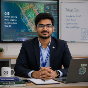
I am a passionate GIS Analyst and Trainer with strong experience in Geographic Information Systems (GIS), Remote Sensing, and Drone Mapping. I specialise in teaching both beginners and advanced learners seeking to build a strong career in geospatial technology.
I have hands-on experience working on real-world projects such as land use land...
As a dedicated and passionate tutor with over 5 years of hands-on experience in GIS, Remote Sensing, Drone Mapping, and Geospatial Analysis, I specialize in breaking down complex spatial concepts into simple, engaging lessons that students can easily understand and apply. Whether you're a beginner trying to navigate ArcGIS or a professional aiming...

Hi all, since my childhood i always wonder about the things happening around me and tries to find out the best possible answer for it. But lack of resources and quality teacher dissapointed me most of the time which helped me in developing a habit of analyser and a rational thinker. This habit still helps me in helping students having weak...

I'm GIS & Remote Sensing expert having around 10 years of experience, During my professional career i have worked with various inland and outland industries which mainly includes Municipal Administration Units of Punjab, PIE London, TFL London. Apart from this i have been teaching GIS and Remote Sensing since last few years. Below are some of my...

Passionate Geography and Remote Sensing educator with over 8 years of experience guiding students to academic excellence. Holding advanced degrees in Geography, I specialize in simplifying complex geospatial concepts using real-world applications and interactive tools like ArcGIS and QGIS. My teaching approach is student-centered, fostering...
- Sairus Khalil
-
5.0

🌟🌟🌟 🚀 Unlock Limitless Learning & Software Solutions with DW Solution Online LTD! 🚀 🌟🌟🌟
Hi there! 👋
💡 Are you struggling with your studies and need expert guidance?
💡 Need help with assignments, quizzes, projects, or exams?
💡 Looking for expert-led tutoring in science, mathematics, engineering, or programming?
💡 Want to...

HI!
Hope everyone is good, I am a GIS Specialist with 7+ years of experience in GIS and Remote Sensig. I give classes to any professional, or student that wants to learn and understand GIS & Remote Sensing and their practical implementation In various research domains in a professional manner. I conduct online classes and I will be helping you to...

I am Malavika, and I have finished my Master's in Geoinformatics. I am currently working as a GIS Freelancer. I have a good grasp of GIS and remote sensing concepts and software. I can help you with any kind of GIS problem by providing theoretical as well as practical knowledge. Given that I was a student, I can understand the requirements of...
Dr. Victor Mutugi Kinyua holds a Ph.D. in Applied Science (Geoinformatics) and is a dedicated educator in General Studies, Hospitality, and Business Technology. He integrates technology, innovation, and practical learning to equip students with essential skills for academic and professional success. With expertise in geospatial analysis, data...

I am a very passionate person, Possessing an ability to adapt to various challenges and scenarios. Extremely motivated and enthusiastic individual and I Look forward to sharing my knowledge and skills with those who have an interest in learning and discussing GIS and remote sensing technologies. I may not have enough experience in teaching but I...

Hey there! 👋
I'm Mahesh, your go-to tutor for making sense of data analysis and proficient in statistical tools, including RStudio, Python, SPSS, STATA, and Excel. Let's keep it simple and dive into the world of stats and visualization together. Whether you're a beginner or aiming for expert status, I'm here to guide you every step of the way....
I'm a Land Surveyor, Geospatial, and Data Analyst with extensive expertise in land surveying, spatial data analysis, geographic information system (GIS), remote sensing, and data modelling. I have successfully managed complex projects, collecting, analysing, and interpreting spatial data to support decisions-making and planning across various...

