
ArcGIS API for JavaScript tutors in postcode 700084
I am a GIS Software Developer with a strong focus on applied geospatial solutions and mentoring learners who aspire to build their skills in GIS. I hold an M.Tech in Geoinformatics (2016) and have over 9 years of professional experience in GIS software development, covering a wide spectrum of domains and technologies.
Throughout my career, I...

With over 13 years of experience and a master's degree, I am a seasoned GIS professional dedicated to helping students excel. My expertise covers fundamental GIS concepts, as well as hands-on training with industry-standard software like ArcGIS and open-source alternatives such as QGIS and OpenGeoServer. I also specialize in geospatial automation...

I'm ESRI Certified (ArcGIS Desktop Professional, ArcGIS JavaScript Specialty, ArcGIS Enterprise Administration Associate, ArcGIS Online Administration Specialty) and Have been in GIS Industry from 11+ Years with hands on experience on most of the prodcuts of ESRI'S ArcGIS Suite including:
ArcGIS Desktop (ArcMap, ArcGIS Pro)
ArcGIS...

Are you looking to master Geographic Information Systems (GIS) and remote sensing with the guidance of an expert? With over 5 years of professional experience in the corporate sector, I offer personalized GIS training that covers industry-leading software such as QGIS, ArcGIS, and more. My teaching style is highly interactive and student-centered,...

Hi! I’m Farhad Ali – Your Friendly GIS Expert & Mentor!
I am a GIS Officer in the telecom sector with a Master’s degree in GIS and 6 years of experience in teaching, mentoring, and technical GIS projects. I am passionate about empowering students to master GIS skills efficiently, confidently, and enjoyably.
I specialize in GIS mapping,...

Enthusiastic Educator & Urban Planning professional with 1.5+ years of GIS experience. Skilled in ArcGIS and ArcGIS Pro, with expertise in Spatial Analyst, digitizing, geodatabase creation, network analysis, image classification, and georeferencing. Adept at crafting informative maps and interactive story maps using ArcGIS Online. University...

I am a Senior Research Fellow (Ph.D.) at the Department of Earth Sciences, IIT Kanpur. I have qualified CSIR JRF (Earth, Atmospheric, Ocean and Planetary Sciences) June 2019 with AIR 42, GATE (Geology & Geophysics) 2019 with AIR 99, and CSIR NET (Earth, Atmospheric, Ocean and Planetary Sciences) June 2018 with AIR 07. I have a strong knowledge of...

I am a very passionate person, Possessing an ability to adapt to various challenges and scenarios. Extremely motivated and enthusiastic individual and I Look forward to sharing my knowledge and skills with those who have an interest in learning and discussing GIS and remote sensing technologies. I may not have enough experience in teaching but I...

I conduct online classes and I do help to complete assignments.
Subjects: Geographic Information System / GIS / Geoinformatics and Remote Sensing (Digital Image Processing, Raster Analysis, Vector Analysis. Mapping.
Software: QGIS, Esri: ArcGIS Desktop, ArcMap, ArcGIS Enterprise or Online, ArcGIS Pro, ERDAS. Programming language- Python, and...
- Anirban Banerjee
-
5.0

Alongside my professional academic life as a researcher, I am privately conducting online classes for school and college students. Make them understand the theory is very important, along with the practical workflows. Seldom, project- and assignment-related help is also given.
◘ Subject overview - Remote Sensing: Image Processing, Spatial...
Hi, I’m Partha Hui. I’m a highly motivated and dedicated young Geospatial professional with a passion for spatial technology. I have a strong educational background in geography and a master's degree in Geospatial Science. I have 4 years of professional experience in the geospatial field with strong analytical and problem-solving skills. I have...

I am a proficient civil and structural engineer. I can teach and help you with subjects like Structural Mechanics, Mechanics of Deformable Solids, Structural Analysis and Design, Soil Mechanics, Construction Management and Project Management, Supply Chain Management.
I have 2+ years of teaching experience in these subjects and all my students...
- Mili Dutta
-
5.0

I am a Ph.D. scholar with expert-level proficiency in SPSS, STATA, R, Python, Advanced Excel, Power BI, Tableau, NVivo, research methodology, sampling design, data cleaning, data automation, dashboard development, and advanced statistical analysis. With a strong academic and professional background, I bring over five years of hands-on experience...
BSc in Geology – Federal University of Ceará (UFC)
Since 2013, I’ve participated in multiple field trips across Ceará (Brazil), building:
• Field leadership skills
• Strong team communication
• Experience coordinating routes, sampling, and lithological analysis
🧪 Research & Practical Experience
• Research grant in Mineralogy, including...
- Nusrat Ullah Hasani
-
3.5

Over 3 years of experience achieving career excellence through committed and innovative work in the field of Remote Sensing and GIS. A versatile team player who thrives in enviroments requiring the ability to work effectively as a team player. Expertise includes satellite image processing and analysis and web GIS.
Provide Support in starting new...

My teaching style is interactive, practical, and student-centered, focusing on making lessons easy to understand by connecting theory to real-life examples. I am a university student pursuing a degree in Urban and Regional Planning, with growing expertise in GIS, Home Science, and related software such as ArcGIS, AutoCAD, SketchUp, SPSS, and...
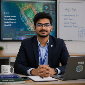
I am a passionate GIS Analyst and Trainer with strong experience in Geographic Information Systems (GIS), Remote Sensing, and Drone Mapping. I specialise in teaching both beginners and advanced learners seeking to build a strong career in geospatial technology.
I have hands-on experience working on real-world projects such as land use land...

I am a hardworking, resourceful, self-motivated individual always desiring to achieve higher goals. I have been able to work with both private and governmental organizations for 4+ years. I have exemplary expertise in GIS products (ArcMap, Q-GIS, ERDAS, ENVI, AutoCAD just to mention a few), R, SQL, Html, CSS and Javascript.
My teaching style...
Welcome! I’m an enthusiastic and dedicated educator with extensive experience in Geography and environmental sciences. As an O Level Subject Coordinator for Geography at a Cambridge curriculum school for two years, I have honed my skills in curriculum development and student engagement, creating a dynamic learning environment that fosters...

Hi, this is vignesh an entrepreneur by profession and a passionate tutor. willing to share best of my knowledge to the younger generation professionals in Architecture, civil engineering and planning. With 8 years of professional experience in the field i have explored many domains and I can help the young professionals employable by tutoring the...

