
Spatial Modelling assignment tutors in postcode 600125

Hi! I’m Farhad Ali – Your Friendly GIS Expert & Mentor!
I am a GIS Officer in the telecom sector with a Master’s degree in GIS and 6 years of experience in teaching, mentoring, and technical GIS projects. I am passionate about empowering students to master GIS skills efficiently, confidently, and enjoyably.
I specialize in GIS mapping,...
I am an analytical and passionate educator with a strong background in statistics, data science, and risk management. Over the years, I have worked as an Assistant Lecturer, guiding undergraduate students in statistics, research methods, and data analysis, while also providing mentorship and academic support.
Currently pursuing a Master’s...
Hello! I am a dedicated Geospatial and Earth Science professional with a strong passion for helping students, researchers, and professionals make sense of spatial data and the physical world.
I have had the privilege of collaborating with researchers across the globe in both the private and government sectors.
Whether you are navigating complex...
- Nadine Trahan
-
5.0

I have been working in GIS for 20 years with virtually all components of ESRI's ArcGIS Suite, including:
• ArcGIS Desktop
• ArcGIS Online
• ArcGIS Portal and Server
• ArcGIS Pro
• ArcHydro
• ArcSDE Enterprise Geodatabases
Teaching GIS users from a wide range of backgrounds and experience has always been one of the most important and...
- Anirban Banerjee
-
5.0

Alongside my professional academic life as a researcher, I am privately conducting online classes for school and college students. Make them understand the theory is very important, along with the practical workflows. Seldom, project- and assignment-related help is also given.
◘ Subject overview - Remote Sensing: Image Processing, Spatial...

HI!
Hope everyone is good, I am a GIS Specialist with 7+ years of experience in GIS and Remote Sensig. I give classes to any professional, or student that wants to learn and understand GIS & Remote Sensing and their practical implementation In various research domains in a professional manner. I conduct online classes and I will be helping you to...
Hey there! 👋 I'm Shinjita, a geospatial researcher and PhD candidate who gets genuinely excited about maps, data, and our planet. Think of me as that person who can look at a forest and see not just trees, but layers of stories, numbers, and possibilities- all waiting to be mapped and understood.
For the past four years at RMIT, I've been deep...

I am a dynamic, results-driven, and highly practical trainer/teacher specializing in Land Surveying, Geospatial Engineering, GIS, Remote Sensing, Mapping, Mathematics, Physics, Chemistry Geography and Biology. I deliver impactful training through both online and physical platforms, using learner-centred, competency-based, and industry-oriented...
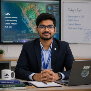
I am a passionate GIS Analyst and Trainer with strong experience in Geographic Information Systems (GIS), Remote Sensing, and Drone Mapping. I specialise in teaching both beginners and advanced learners seeking to build a strong career in geospatial technology.
I have hands-on experience working on real-world projects such as land use land...

I know how tedious it can be try to pick up skills like arcgis pro, I have gone through this process myself and I believe I can help you on your journey to tackle these. One difficult thing I have figured while tutoring is that most of the students don’t even know the use cases of what they intend to learn. With me you don’t have to worry as we...
I am a GIS professional with hands-on experience in Geographic Information Systems (GIS) and a growing background in online teaching. I have recently started teaching GIS and supporting students with assignments, and I focus on explaining concepts in a clear, simple, and practical manner so learners can easily follow and apply them.
I help...

I am a hardworking, resourceful, self-motivated individual always desiring to achieve higher goals. I have been able to work with both private and governmental organizations for 4+ years. I have exemplary expertise in GIS products (ArcMap, Q-GIS, ERDAS, ENVI, AutoCAD just to mention a few), R, SQL, Html, CSS and Javascript.
My teaching style...
Welcome! I’m an enthusiastic and dedicated educator with extensive experience in Geography and environmental sciences. As an O Level Subject Coordinator for Geography at a Cambridge curriculum school for two years, I have honed my skills in curriculum development and student engagement, creating a dynamic learning environment that fosters...

I have more than 12 years experience in GIS and RS domain in corporate, government and teaching sector in different cities of India. And I have ability to share my knowledge to different types of students and can mentor them for professional growth and development.
Also I worked on different types of projects, so I can possible to explain all...
Hi I am a fun based teacher ..
I conduct more activity to understand the concept and review your answer to know or test student understanding..
My class always be an interactive one, I ask more questions to bring the answer from the students
I use more technology in my lesson, through this I can engage students more effectively.So student wont...

Experienced in Research, Industry, and Academics, I will be able to teach and train the learner.
My teaching style is based on several core principles: engagement, personalization, clarity, and continuous improvement.
I will keep myself updated with the present world and assist the learners with the current world examples which will assist in...

I am a dedicated GIS Tutor with over 5 years of hands-on experience in Geographic Information Systems, Remote Sensing, and spatial data analysis. I specialize in teaching both theoretical concepts and practical GIS applications, including QGIS, ArcGIS, Global Mapper, and Python-based GIS workflows. My teaching approach focuses on real-world use...
About Me:
I am currently working as an Assistant Engineer in the Water Resources Department, with hands-on experience in irrigation engineering and GIS tools. My teaching methodology is practical and application-based—I focus on real-world examples, step-by-step problem-solving, and interactive exercises. I help students understand how concepts...
- Ayodele Michael Agboola
-
5.0

I have well over eight years of experience in developing and managing GIS data, creating map services, conducting research, and performing GIS analysis. Effectively performed GIS and remote sensing data collection, management, processing, and analysis using various software packages. Interact easily with people from diverse backgrounds, cultures,...

I provide thorough assistance in GIS learning, GIS projects, remote sensing data processing. I am a highly organized and qualified teacher with more than 6 years of experience. I have thorough knowledge in geography theory and practical lessons and also Geoinformatics. I provide study material for GIS and remote sensing for graduation or masters...

